- Active
395 A 96 Street
Oliver · Agriculture
Listed by PG Direct Realty · MLS® 10394233
There is more to this listing. Create a free account to see the exact location, taxes, room sizes and price history.
Sign inAbout this home
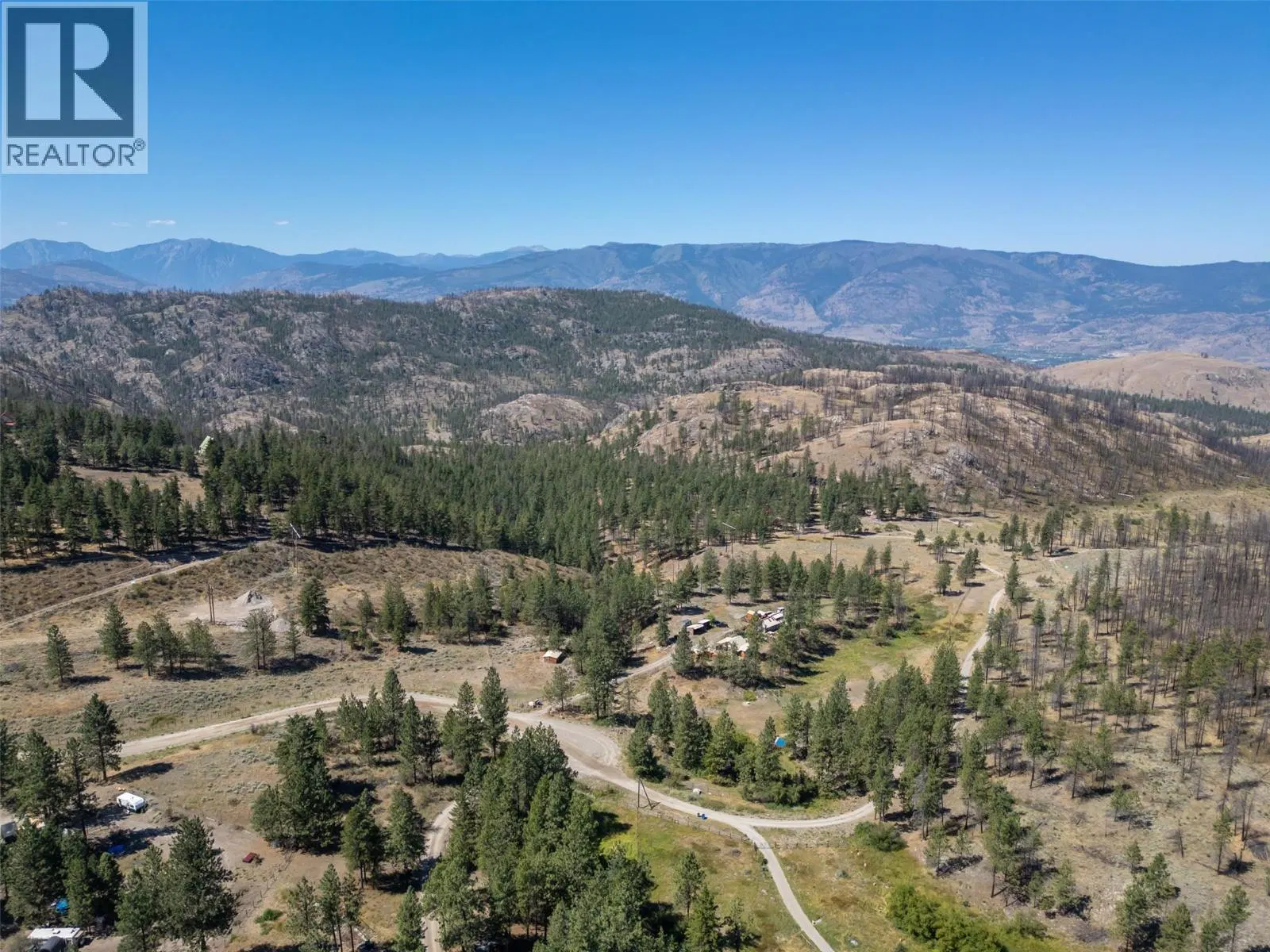
Visit REALTOR website for additional information. Water borders three sides of this nearly 5-acre AG1 property, where the original Oxbows continue to follow their natural meandering course through one of the South Okanagan’s most distinctive landscapes. Flat, fenced, and cross-fenced, the land has remained largely in its natural state in an area where many surrounding parcels have been developed as orchards or vineyards. Mature trees, resident wildlife, and generous separation from neighbouring homes create a setting that feels remarkably secluded while remaining less than five minutes from Highway 97. Access is via Road 20 and Aspen Street, approximately 15 minutes from both Oliver and Osoyoos, passing Kismet Estate Winery. Water is supplied by a drilled well, hydro is available at the property line, and an existing 2,300 sq ft off-grid auxiliary building is already in place. Zoned AG1 under the Regional District of Okanagan-Similkameen, the property permits a range of agricultural and accessory uses consistent with the bylaw, including opportunities for pasture or other agricultural uses, subject to buyer verification. Buyers should confirm their intended use directly with RDOS Planning. A distinctive South Okanagan acreage where the landscape has remained largely unchanged, offering riverfront surroundings, natural beauty, and convenient access to Oliver, Osoyoos, and Highway 97.
Home facts
- Property type
- Agriculture
- Area
- Oliver
- Listed
- July 9, 2026
- Structure
- Other
- PID
- 011-383-003
- Common interest
- Freehold
Highlights
- Mountain view
Features and inclusions
- Lot
- Level lot, Private setting, Treed, Irregular lot size
- Community
- Rural Setting
Rooms and building
- Sewer
- No sewage system
- Water
- Well
- Utilities
- Water, Electricity

The information contained on this site is based in whole or in part on information that is provided by members of The Canadian Real Estate Association (CREA), who are responsible for its accuracy. CREA reproduces and distributes this information as a service for its members and assumes no responsibility for its accuracy.
Monthly and upfront costs
Uses the posted 5-year rate (5.19%), 20% down and a 25-year amortization.
Monthly ownership costs
- Principal and interest
- $4,265
- Property tax
- $258/mo
- Home insurance
- $150/mo
- Estimated monthly total
- $4,674
Purchase snapshot
- List price
- $899,900
- Down payment
- $179,980 (20%)
- Estimated mortgage
- $719,920
Estimates only. They leave out utilities, upkeep and closing costs.
Borrowing costs
What money costs right now
The rates behind any payment estimate on this page.
- Prime rate
- 4.45%
- Variable mortgages are quoted against this.
- 5 year bond yield
- 3.68%
- Fixed mortgage pricing follows this.
- Policy rate
- 2.25%
- Set by the Bank of Canada.
These are benchmark rates, not mortgage quotes. Your rate depends on the lender, the term, and your file.
Source: Bank of Canada. As of 2026-09-29
Property tax
What the tax bill looks like
Municipal, regional, hospital and school rates combined.
- Estimated annual tax
- $5,014
- At 5.5719 per $1,000 of assessed value.
Estimated by applying the municipal rate to the asking price. Your actual bill is based on the BC Assessment value, which is set separately and usually differs from the sale price. Home owner grants are not included.
Source: Province of British Columbia, Local Government Statistics Schedule 702, 2026. As of 2026-01-01
Neighbourhood
Estimated travel times. Map data © OpenStreetMap contributors.
Land and hazards
What the maps say about this land
Provincial designations and mapped natural hazards at this location.
- Agricultural Land Reserve
- In the ALR
- Provincial farmland protection restricts subdivision and non-farm use.
- Wildfire interface
- Extreme risk
- In a mapped wildland-urban interface zone. Affects insurance and FireSmart requirements.
Based on where this point falls in provincial map layers, not a site survey or a formal hazard assessment. Confirm with the municipality, a professional, and your insurer before relying on it.
Source: BC Geographic Warehouse (Agricultural Land Commission, BC Wildfire Service)
Most listed
Detached · 71%
Who lives here
Documents
Pick the records you want. Ray Rasouli will email what the listing brokerage shares.
Availability is not guaranteed. Review documents with a professional.