- Active
6778 97A Highway
Grindrod · Single Family
- Beds
- 5
- Baths
- 3
- Sqft
- 3,129
- Built
- 1979
Listed by RE/MAX Vernon · MLS® 10399234
There is more to this listing. Create a free account to see the exact location, taxes, room sizes and price history.
Sign inAbout this home
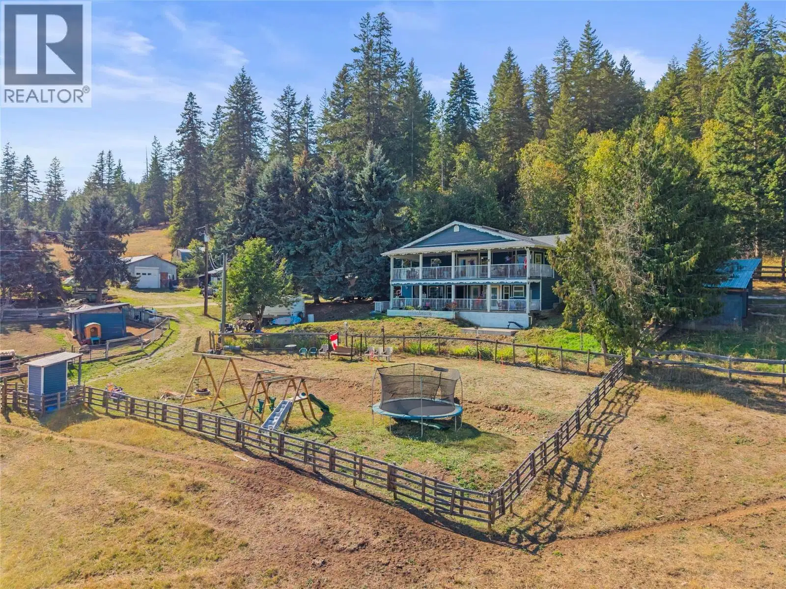
A rare opportunity in Grindrod! Known locally as the former Giesbrecht equestrian centre, this 37 acre property offers an approx. 3,000 sq ft, 6 bed, 3 bath home, exceptional livestock infrastructure, versatile outbuildings and privacy. About 9 acres around the home are fenced and cross fenced with paddocks, 9 three sided shelters, power and frost free hydrants to most paddocks, plus a fenced kids play area. Approx. 5 acres are cleared above, with about 23 acres of mature cedar and fir forest, trails and potential timber value. Two 16 x 52 covered decks with skylights capture valley and Enderby Cliffs views. Recent upgrades include oak cabinetry, accent and LED lighting, 2 full size fridges, double wall ovens, propane cooktop, island with prep sink, garburator and reverse osmosis tap, plus a butler's kitchen with dishwasher, deep sink and storage. Also includes propane dryer, deep soaker tub and showers in both lower bathrooms. Outside are 2 insulated shops with subpanels, attached workshop, pole barn, chicken coop, 2 car covered parking, working outhouse, sand jump arena, grass dressage arena and covered RV site with deck, power, water and septic. Main well estimated 3 to 5 GPM plus unused irrigation well. Lower land has supported gardens, orchard, sheep, chickens and summer cattle. Lower acreage is in the ALR and upper portion is NU zoned, with potential for a second residence subject to applicable approvals. Approx. 30 to 35 min to Vernon and 20 min to Salmon Arm.
Home facts
- Bedrooms
- 5
- Bathrooms
- 3 full
- Interior
- 3,129 sq ft
- Year built
- 1979
- Storeys
- 2
- Parking
- 15
- Property type
- Single Family
- Carport
- Yes
- Area
- Enderby / Grindrod
- Listed
- September 3, 2026
- Structure
- House
- Frontage
- 609 feet
- PID
- 010-922-415
- Common interest
- Freehold
Highlights
- Mountain view
Features and inclusions
- Appliances
- Washer, Refrigerator, Cooktop - Gas, Range - Gas, Dishwasher, Dryer, Oven - Built-In
- Heating
- Forced air, See remarks
- Cooling
- Central air conditioning
- Flooring
- Tile, Hardwood, Vinyl
- Roof
- Asphalt shingle, Unknown
- Parking
- Carport, Additional Parking
- Lot
- Private setting, Treed, Irregular lot size, Sloping, Central island, Two Balconies
- Community
- Rural Setting, Pets Allowed, Pets Allowed With Restrictions, Rentals Allowed
Rooms and building
- Sewer
- Septic tank
- Water
- Dug WellWell

The information contained on this site is based in whole or in part on information that is provided by members of The Canadian Real Estate Association (CREA), who are responsible for its accuracy. CREA reproduces and distributes this information as a service for its members and assumes no responsibility for its accuracy.
Monthly and upfront costs
Uses the posted 5-year rate (5.19%), 20% down and a 25-year amortization.
Monthly ownership costs
- Principal and interest
- $6,399
- Property tax
- $392/mo
- Home insurance
- $150/mo
- Estimated monthly total
- $6,940
Purchase snapshot
- List price
- $1,350,000
- Down payment
- $270,000 (20%)
- Estimated mortgage
- $1,080,000
Estimates only. They leave out utilities, upkeep and closing costs.
Borrowing costs
What money costs right now
The rates behind any payment estimate on this page.
- Prime rate
- 4.45%
- Variable mortgages are quoted against this.
- 5 year bond yield
- 3.68%
- Fixed mortgage pricing follows this.
- Policy rate
- 2.25%
- Set by the Bank of Canada.
These are benchmark rates, not mortgage quotes. Your rate depends on the lender, the term, and your file.
Source: Bank of Canada. As of 2026-09-29
Neighbourhood
Estimated travel times. Map data © OpenStreetMap contributors.
Land and hazards
What the maps say about this land
Provincial designations and mapped natural hazards at this location.
- Agricultural Land Reserve
- In the ALR
- Provincial farmland protection restricts subdivision and non-farm use.
- Wildfire interface
- Extreme risk
- In a mapped wildland-urban interface zone. Affects insurance and FireSmart requirements.
Based on where this point falls in provincial map layers, not a site survey or a formal hazard assessment. Confirm with the municipality, a professional, and your insurer before relying on it.
Source: BC Geographic Warehouse (Agricultural Land Commission, BC Wildfire Service)
Most listed
Detached · 47%
Who lives here
Documents
Pick the records you want. Ray Rasouli will email what the listing brokerage shares.
Availability is not guaranteed. Review documents with a professional.