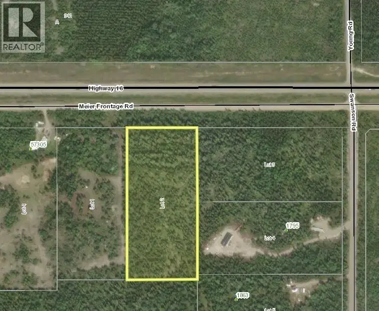
- Active
LOT 2 MEIER FRONTAGE Road
Cluculz Lake · Vacant Land
Listed by RE/MAX Core Realty · MLS® R3182663
There is more to this listing. Create a free account to see the exact location, taxes, room sizes and price history.
Sign inCluculz Lake · Vacant Land
Listed by RE/MAX Core Realty · MLS® R3182663
There is more to this listing. Create a free account to see the exact location, taxes, room sizes and price history.
Sign in4.9 acre lot with frontage rd access to the Hwy. This flat fully treed lot is a perfect hold or develop acreage. Minutes from Cluculz Lake and public boat launch.

The information contained on this site is based in whole or in part on information that is provided by members of The Canadian Real Estate Association (CREA), who are responsible for its accuracy. CREA reproduces and distributes this information as a service for its members and assumes no responsibility for its accuracy.
Uses the posted 5-year rate (5.19%), 20% down and a 25-year amortization.
Estimates only. They leave out utilities, upkeep and closing costs.
Estimated travel times. Map data © OpenStreetMap contributors.
Most listed
Land · 60%
Active listings within 8 km of this home.
Source: Statistics Canada, 2021 Census of Population. 305 dwellings.
Statistics Canada area 59510277 · Bulkley-Nechako F
Source: Statistics Canada, 2021 Census Profile, dissemination area 59510277.
Pick the records you want. Ray Rasouli will email what the listing brokerage shares.
Availability is not guaranteed. Review documents with a professional.
For investors
Estimated rent from Statistics Canada rents for this area, scaled to the bedrooms. Gross yield is 12 months of that rent over the asking price, before costs.
Borrowing costs
The rates behind any payment estimate on this page.
These are benchmark rates, not mortgage quotes. Your rate depends on the lender, the term, and your file.
Source: Bank of Canada. As of 2026-10-29
Land and hazards
Provincial designations and mapped natural hazards at this location.
Based on where this point falls in provincial map layers, not a site survey or a formal hazard assessment. Confirm with the municipality, a professional, and your insurer before relying on it.
Source: BC Geographic Warehouse (Agricultural Land Commission, BC Wildfire Service)